Best Time to Visit Antelope Canyon Arizona
Month-by-month climate averages for Page, plus the seasonal conditions that touch canyon visits and water activities
Temperatures month by month
The climate figures below are 1991–2020 averages for Page, Arizona. Each month has a mean daily maximum, a daily mean and a mean daily minimum temperature, followed by average precipitation and the average number of days with at least 0.01 in of precipitation.
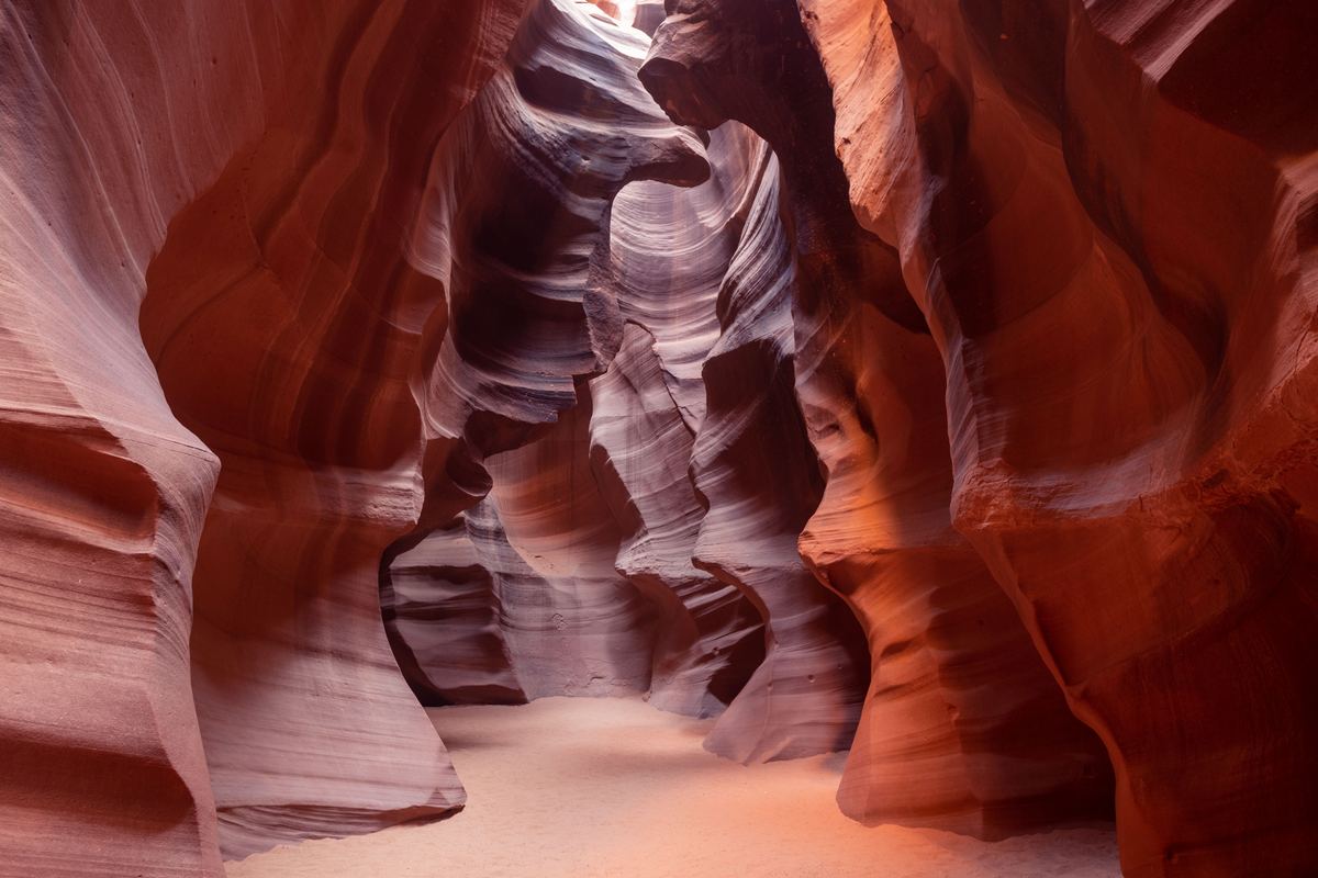
| Month | Mean daily maximum | Daily mean | Mean daily minimum |
|---|---|---|---|
| January | 44.6 °F (7.0 °C) | 35.5 °F (1.9 °C) | 26.4 °F (−3.1 °C) |
| February | 51.3 °F (10.7 °C) | 40.8 °F (4.9 °C) | 30.4 °F (−0.9 °C) |
| March | 61.8 °F (16.6 °C) | 49.7 °F (9.8 °C) | 37.6 °F (3.1 °C) |
| April | 70.5 °F (21.4 °C) | 57.4 °F (14.1 °C) | 44.4 °F (6.9 °C) |
| May | 80.7 °F (27.1 °C) | 67.1 °F (19.5 °C) | 53.6 °F (12.0 °C) |
| June | 92.2 °F (33.4 °C) | 77.8 °F (25.4 °C) | 63.4 °F (17.4 °C) |
| July | 96.5 °F (35.8 °C) | 83.1 °F (28.4 °C) | 69.7 °F (20.9 °C) |
| August | 93.5 °F (34.2 °C) | 80.5 °F (26.9 °C) | 67.6 °F (19.8 °C) |
| September | 84.9 °F (29.4 °C) | 72.1 °F (22.3 °C) | 59.4 °F (15.2 °C) |
| October | 70.9 °F (21.6 °C) | 58.8 °F (14.9 °C) | 46.8 °F (8.2 °C) |
| November | 55.2 °F (12.9 °C) | 44.9 °F (7.2 °C) | 34.5 °F (1.4 °C) |
| December | 43.8 °F (6.6 °C) | 35.4 °F (1.9 °C) | 26.9 °F (−2.8 °C) |
Long-term average of the mean daily maximum for each month.
| Item | Value (°F) |
|---|---|
| January | 44.6 |
| February | 51.3 |
| March | 61.8 |
| April | 70.5 |
| May | 80.7 |
| June | 92.2 |
| July | 96.5 |
| August | 93.5 |
| September | 84.9 |
| October | 70.9 |
| November | 55.2 |
| December | 43.8 |
Check dates and prices
Precipitation month by month
Precipitation in Page, Arizona is shown as the average amount for each month and as the average number of days in that month with at least 0.01 in of precipitation. Both columns are 1991–2020 averages.
| Month | Average precipitation | Days with at least 0.01 in of precipitation |
|---|---|---|
| January | 0.65 in (17 mm) | 4.1 days |
| February | 0.51 in (13 mm) | 5.3 days |
| March | 0.54 in (14 mm) | 4.5 days |
| April | 0.38 in (9.7 mm) | 3.6 days |
| May | 0.44 in (11 mm) | 2.7 days |
| June | 0.13 in (3.3 mm) | 1.4 days |
| July | 0.58 in (15 mm) | 3.5 days |
| August | 0.93 in (24 mm) | 6.5 days |
| September | 0.93 in (24 mm) | 4.6 days |
| October | 0.92 in (23 mm) | 4.1 days |
| November | 0.45 in (11 mm) | 2.9 days |
| December | 0.42 in (11 mm) | 4.2 days |
December to February
- December: the mean daily maximum is 43.8 °F (6.6 °C), the daily mean is 35.4 °F (1.9 °C) and the mean daily minimum is 26.9 °F (−2.8 °C). Average precipitation is 0.42 in (11 mm), spread over 4.2 days with at least 0.01 in.
- January: the mean daily maximum is 44.6 °F (7.0 °C), the daily mean is 35.5 °F (1.9 °C) and the mean daily minimum is 26.4 °F (−3.1 °C). Average precipitation is 0.65 in (17 mm), spread over 4.1 days with at least 0.01 in.
- February: the mean daily maximum is 51.3 °F (10.7 °C), the daily mean is 40.8 °F (4.9 °C) and the mean daily minimum is 30.4 °F (−0.9 °C). Average precipitation is 0.51 in (13 mm), spread over 5.3 days with at least 0.01 in.
March to May
- March: the mean daily maximum is 61.8 °F (16.6 °C), the daily mean is 49.7 °F (9.8 °C) and the mean daily minimum is 37.6 °F (3.1 °C). Average precipitation is 0.54 in (14 mm), spread over 4.5 days with at least 0.01 in.
- April: the mean daily maximum is 70.5 °F (21.4 °C), the daily mean is 57.4 °F (14.1 °C) and the mean daily minimum is 44.4 °F (6.9 °C). Average precipitation is 0.38 in (9.7 mm), spread over 3.6 days with at least 0.01 in.
- May: the mean daily maximum is 80.7 °F (27.1 °C), the daily mean is 67.1 °F (19.5 °C) and the mean daily minimum is 53.6 °F (12.0 °C). Average precipitation is 0.44 in (11 mm), spread over 2.7 days with at least 0.01 in.
June to August
- June: the mean daily maximum is 92.2 °F (33.4 °C), the daily mean is 77.8 °F (25.4 °C) and the mean daily minimum is 63.4 °F (17.4 °C). Average precipitation is 0.13 in (3.3 mm), spread over 1.4 days with at least 0.01 in.
- July: the mean daily maximum is 96.5 °F (35.8 °C), the daily mean is 83.1 °F (28.4 °C) and the mean daily minimum is 69.7 °F (20.9 °C). Average precipitation is 0.58 in (15 mm), spread over 3.5 days with at least 0.01 in.
- August: the mean daily maximum is 93.5 °F (34.2 °C), the daily mean is 80.5 °F (26.9 °C) and the mean daily minimum is 67.6 °F (19.8 °C). Average precipitation is 0.93 in (24 mm), spread over 6.5 days with at least 0.01 in.
September to November
- September: the mean daily maximum is 84.9 °F (29.4 °C), the daily mean is 72.1 °F (22.3 °C) and the mean daily minimum is 59.4 °F (15.2 °C). Average precipitation is 0.93 in (24 mm), spread over 4.6 days with at least 0.01 in.
- October: the mean daily maximum is 70.9 °F (21.6 °C), the daily mean is 58.8 °F (14.9 °C) and the mean daily minimum is 46.8 °F (8.2 °C). Average precipitation is 0.92 in (23 mm), spread over 4.1 days with at least 0.01 in.
- November: the mean daily maximum is 55.2 °F (12.9 °C), the daily mean is 44.9 °F (7.2 °C) and the mean daily minimum is 34.5 °F (1.4 °C). Average precipitation is 0.45 in (11 mm), spread over 2.9 days with at least 0.01 in.
Summer rain, flooding and fire restrictions
Rainfall during the summer season can flood Antelope Canyon quickly, and this is one reason entry is by guided tour only. Closures after flash flooding can last up to several months. Consistent North American monsoons do not reach Page, which is too far north. August records an average of 0.93 in (24 mm) of precipitation over 6.5 days with at least 0.01 in. In the dry summer months, the Navajo Nation may have fire restrictions in force.
Canyon visits and trails
Every Antelope Canyon location requires a guide, which limits visits to guided tours. Time spent inside Upper Antelope Canyon is capped at two hours. Even with stairways installed, Lower Antelope Canyon is the harder hike of the two canyons. Inside Navajo Tribal Park lands, rules strictly forbid cremation, littering, rock climbing, camping and drones.
Hiking in Glen Canyon National Recreation Area means following routes over uneven terrain, since the Horseshoe Bend trail is the only maintained trail there. That trail to the rim meets Architectural Barriers Act accessibility standards.
Water activities and their rules
- Raft float trips on smooth water run along the Colorado River from Lees Ferry to Horseshoe Bend and back.
- Lake Powell Resorts and Marinas rents boats and water toys out of Wahweap and Halls Crossing.
- Kayakers can paddle about 1 to 2 miles into the flooded canyon, depending on water levels as of 2024, and then continue on foot.
- Anyone on a personal watercraft must wear a life jacket at all times, whatever their age.
- Personal watercraft are not allowed on the Colorado River at Lees Ferry.
- In Utah, children aged 12-17 who want to operate a personal watercraft must first take a certification course.
- Because quagga mussels are present, all boaters and fishermen must clean, drain and dry vessels and equipment after contact with Lake Powell waters.
Questions about timing
Frequently asked questions
Is a guide required at Antelope Canyon?
Yes. A guide is mandatory at every Antelope Canyon location, so visits happen only on a guided tour.
What is the time limit inside Upper Antelope Canyon?
Two hours is the ceiling for a visit inside the upper canyon.
What is the mean daily maximum temperature in Page in July?
In July the mean daily maximum in Page, Arizona is 96.5 °F (35.8 °C), based on 1991–2020 averages.
How many days of precipitation does Page have in August?
August averages 6.5 days with at least 0.01 in of precipitation, and the average precipitation is 0.93 in (24 mm).
Can flash flooding close Antelope Canyon?
Closures after flash flooding can last up to several months.
Does Page get monsoons?
Consistent North American monsoons do not reach Page, which is too far north.
How far into the flooded canyon can kayakers go?
Roughly 1 to 2 miles, depending on water levels as of 2024. After that, exploring continues on foot.
Antelope Canyon tours
Related pages
Sources
- Page, Arizona - Wikipedia
- Antelope Canyon
- Page
- Camping - Navajo National Monument (U.S. National Park Service)
- Antelope Canyon Tour Operators | Navajo Nation Parks & Recreation
- Lake Powell Navajo Tribal Park | Navajo Nation Parks & Recreation
- Navajo Nation Parks & Recreation | Navajo Park Tours in AZ
- Accessibility - Glen Canyon National Recreation Area (U.S. National Park Service)
- Guided Tours - Glen Canyon National Recreation Area (U.S. National Park Service)
- Boating - Glen Canyon National Recreation Area (U.S. National Park Service)